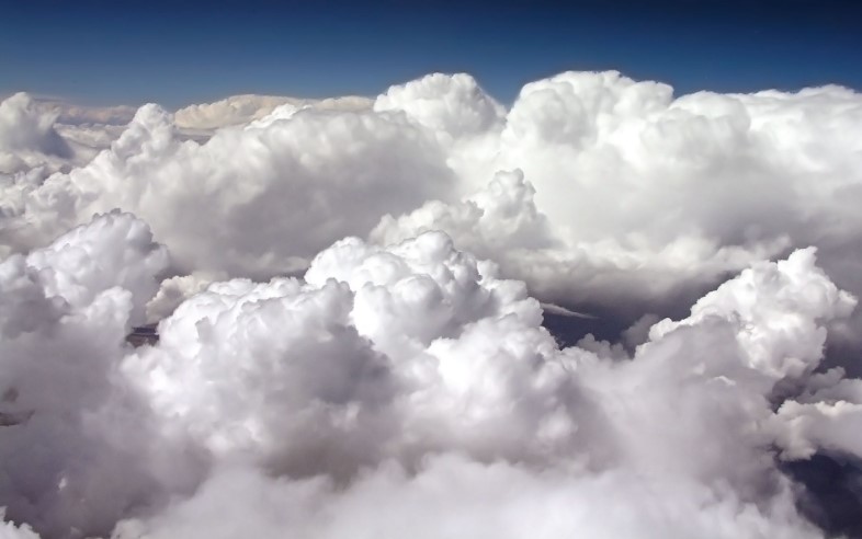
Types of Clouds – How small indeed, when gazing up at a towering raincloud or fast-moving wisps lit by the morning sun, do we feel when watching clouds in the sky? Humanity has always made a hobby, a pastime and science of these puffy white giants, which can be so beautiful and innocuous, or harsh and punishing.
While in reality, there are as many different kinds of clouds as the forces of nature can conjure, meteorologists have created a classification system to group the many types based mainly on height and appearance.
As you can imagine, even in this attempt to structure something as nebulous as a cloud, there are many classifications and sub-classifications. This article will shed some light on the major types.
What is a cloud?

Before getting into the types of clouds, it’s worth taking some time to explain what a cloud actually is. The simplest way to describe a cloud is that it’s the manifestation of water suspended in the earth’s atmosphere.
As part of the earth’s water cycle of evaporation, condensation and precipitation, clouds are the middle part, when droplets or frozen crystals are held in the air.
Warmth evaporates water from bodies of water on the surface, the warmed vapor travels up, and when it cools sufficiently, clouds become visible.
Amount of vapor, airflow and temperature determine the type of cloud, and once there is enough water trapped, precipitation happens.
Depending on the movement of the cloud, due mostly to differences in hot and cold currents of air, altitude, and density of water, we get the main different types of clouds.
The types of clouds that produce weather in our atmosphere are called tropospheric clouds, in that they form in the troposphere, the lowest layer of the atmosphere.
There are also clouds that form in the higher levels of the atmosphere – the mesosphere and the stratosphere. But we are mostly referring to tropospheric clouds when we talk about the different types we observe in the sky, and that’s what we’ll refer to here.
Main Types of Clouds
The first set of classifications refers to the general appearance of clouds, based on the behavior of the water suspended in the air.
They are grouped into three main categories, with Latin derived names that translate to how the layman could describe them in their most basic forms.
When combined with other characteristics or categorized by altitude, these basic forms take on prefixes that describe the more specific category of cloud within each main type. The three types are:
1. Cumulus
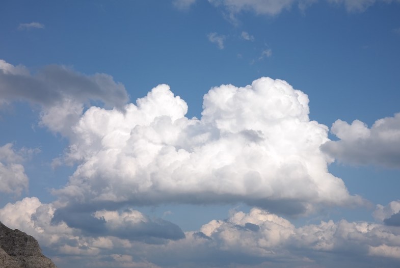
The Latin translation is “heap” or “pile,” describing clouds that build into tall vertical heaps due to upward growth as a result of convection, or the movement resulting from hot air rising and cold air falling.
These clouds are generally described as puffy or like cotton. Basic cumulus clouds are early stages of cloud life and usually low in the atmosphere, later transforming into other types of clouds.
2. Stratus
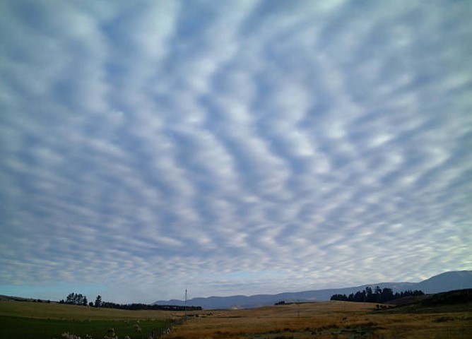
This means, “layer,” and describes just that type of appearance, layered sheets of clouds. Stratus clouds in their most basic description are uniform blankets of clouds, mostly shapeless and sometimes giving off a light rain or drizzle.
3. Cirrus
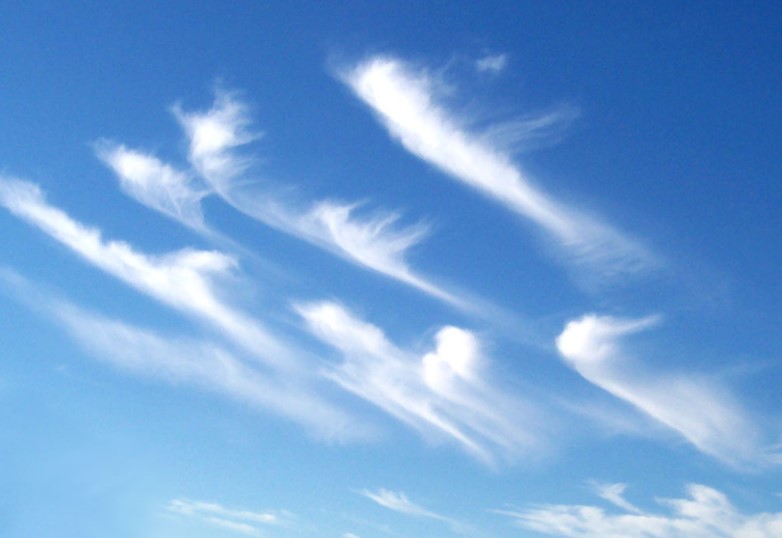
This translates to “curl of hair” and refers to clouds that form wispy strands in the sky. In the most basic form, cirrus clouds look almost like you took a huge paintbrush and drew a few strokes across the sky. They exist very high in the atmosphere as white shoots or tufts of condensation and do not give off any precipitation.
4. Nimbus
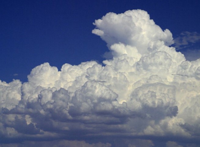
A fourth main Latin term used in cloud classification is “nimbus.” This description is the most literal, as nimbus means, “rain,” and the term is added to other cloud names to indicate they are a variant that produces precipitation (although not limited to rain). Unlike the other three, there is no basic nimbus cloud, as the term is paired with other cloud types, such as cumulonimbus.
Further Classification – Types of Clouds, Categorized by Altitude
Beyond these four classifications, there are many other prefixes and sub-classifications that can be added on to further describe cloud types.
The other main way to divide up clouds, however, is by altitude—how high they are. Here are the ten main types of clouds, categorized by altitude.
High Altitude Clouds
1. Cirrus
See above. Cirrus clouds are the most common type of high cloud. These are the wisps of clouds streaked across the sky. They are so high up they are almost entirely made up of ice, create no precipitation, and usually are visible on a nice day when the lower atmosphere is clear.
2. Cirrostratus
With cirrus the wispy category, and stratus the thin layer cousin that exists at lower altitudes, it won’t be surprising that cirrostratus is similar in appearance to both. This type is basically a cirrus cloud that looks more like a stratus cloud, so more of a widespread wispy layer, like a veil.
3. Cirrocumulus
This category is similar to the first two, but more solid in appearance so the clouds appear as a field of very small puffs. They appear in small lumps that form in rows across the sky, like ripples in a choppy lake. A sky full of these clouds is sometimes called a “mackerel sky” because it resembles the scales of a fish.
Mid-level Clouds
4. Altocumulus
These clouds form in a wide variety of shapes and sizes, but larger than cirrocumulus clouds higher up. The clouds are medium-sized puffs that are a combination of gray and white and form in groups.
If you ever looked up at the sky as a kid and picked out shapes of other objects in the clouds, they were probably altocumulus.
5. Altostratus
Like altocumulus, this variety is made up entirely of water droplets, but do not produce significant amounts of rain. They are gray or blue-gray in appearance and may appear to be watery or fuzzy around the sun or moon. They look a bit thicker or puffier than the lower stratus clouds.
Low-level Clouds
6. Stratus
See above. This type is a low, uniform layer of clouds across the sky.
7. Stratocumulus
Hybrids of thick stratus and puffy cumulus. When you look up and see a wide field of chunky clouds, clumped together and having thin and thick parts, those are stratocumulus. They are grey, but can create some beautiful cascades of color during a sunset.
8. Nimbostratus
Low, dark gray clouds that often will fill the entire sky and produce rain or snow. Days that are socked in with dark, dense, rainy skies have nimbostratus clouds.
Clouds with Vertical Growth
9. Cumulus
Also known as “Fair Weather Cumulus” these are large, white puffs of cotton floating across the sky. They are sort of your stereotypical cloud shape, the kind a child might draw, with a large flat base and puffy or jagged edges.
These clouds have grown from rising drafts of warm air, and are bigger than your fist when held up at arm’s length to compare.
10. Cumulonimbus
The big guys. These are everyone’s favorite, right? Monstrous towering clouds that grow from strong drafts of warm air, then balloon out like a mushroom or anvil at the top.
Also known as thunderheads, these can grow to 40,000 feet or higher, and produce heavy rain, hail or snow. Cumulonimbus clouds can occasionally spawn a tornado.
The “Other” (Weird) Clouds
Those are the main types of clouds you’re likely to see in the sky on any given day, but again, there’s a wide range of possibilities. There’s a whole set of “unusual clouds” that don’t fit into any of the main categories and may form out of other odd phenomena than your daily weather patterns.
For example, contrails are long streaks across the sky, resembling tails. These are formed by the exhaust from jet engines, which in high enough altitudes turn into ice crystals and form these “condensation trails” or contrails.
Mammatus clouds appear on the undersides of cumulonimbus clouds, and are commonly described as “drooping” or “pouch-like.” They look a bit like bubbling water when it’s at a rolling boil.
And finally, just in 2009, a new type of cloud was named by the Cloud Appreciation Society, and if approved will be the first new formation added in more than 50 years – the Undulus Asperatus.
These are dark and stormy clouds that undulate along the bottom in big, menacing waves or ridges. They are somewhat rare, but appear in the Plains states of the U.S.
